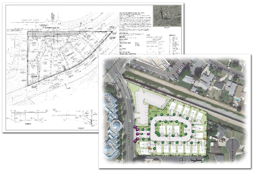
Simply put, the California Subdivision Map Act (“SMA”)is a law that regulates the division of land into smaller parcels for the purpose of development. The Act applies to all subdivisions of land in California, whether the parcels are created for residential, commercial, or industrial development.

In General:
Under the SMA, any proposed subdivision of land must be approved by the local government, usually the city or county, before development can occur. The Act requires developers to prepare a tentative map that shows the proposed layout of the subdivision, including the location of streets, lots, and other features. The local government reviews the tentative map to ensure that it meets certain requirements, such as compliance with zoning regulations, environmental laws, and public health and safety standards.
“The purpose of the Subdivision Map Act is to regulate and control design and improvement of subdivisions with proper consideration for their relation to adjoining areas; require subdividers to install streets and other improvements; prevent fraud and exploitation; and protect both the public and purchasers of subdivided lands.” (Pratt v. Adams (1964) 229 Cal.App.2d 602.)
The goal of the SMA is to ensure that new subdivisions are designed and constructed in a way that is safe and efficient, and that meets the needs of the community. By requiring developers to go through a rigorous review process and provide certain public improvements, the Act helps to ensure that new subdivisions are of high quality and provide benefits to both the developer and the public.
Tentative Map:
The goal of the tentative map process is to ensure that new subdivisions are designed and constructed in a way that is safe and efficient, and that meets the needs of the community. By requiring developers to go through a rigorous review process and provide detailed information about the proposed subdivision, the tentative map process helps to ensure that new subdivisions are of high quality and provide benefits to both the developer and the public.
Once prepared by the developer with detailed information about the proposed subdivision, such as the location and dimensions of the individual parcels, the proposed layout of streets and other infrastructure, and any other relevant details about the proposed development.
Once submitted to the local government for review and approval, the local government reviews the map to ensure that it meets certain requirements, such as compliance with zoning regulations, environmental laws, and public health and safety standards. The local government may also require changes to the map before approving it.
If approved, the developer may proceed with the development of the subdivision. However, before final approval can be granted, the developer must typically submit a final map that reflects any changes required by the local government during the review process.
Final Map:
The final map is a detailed document that shows the precise layout of the subdivision, including the location and dimensions of individual parcels, the layout of streets and other infrastructure, and any other relevant details about the development.
The final map is a critical component of the subdivision process and is intended to ensure that the development is consistent with the approved tentative map and that it meets all applicable laws and regulations. By requiring developers to go through a rigorous review process and submit a final map that accurately reflects the approved subdivision, the state of California helps to ensure that new developments are of high quality and provide benefits to both the developer and the public.
The local government reviews the map to ensure that it accurately reflects the approved tentative map and that all required changes have been made. If approved, it is recorded with the county recorder’s office, which creates a legal record of the subdivision. Once the final map is recorded, the parcels can be sold or developed.
Please see our other related articles
Parcels of Land
Lot Line Adjustments
Why Use Bushore Real Estate
Disclaimer: Every situation is different and particular facts may vary thereby changing or altering a possible course of action or conclusion. The information contained herein is intended to be general in nature as laws vary between federal, state, counties, and municipalities and therefore may not apply to any given matter. This information is not intended to be legal advice or relied upon as a legal opinion, course of action, accounting, tax, or other professional services. You should consult the proper legal or professional advisor knowledgeable in the area that pertains to your particular situation.
